Keeping Lake Tahoe Blue
Due to increasing human activities and urban development around Lake Tahoe, its famed clarity, which once measured 100 feet deep, has declined 30% since 1968.
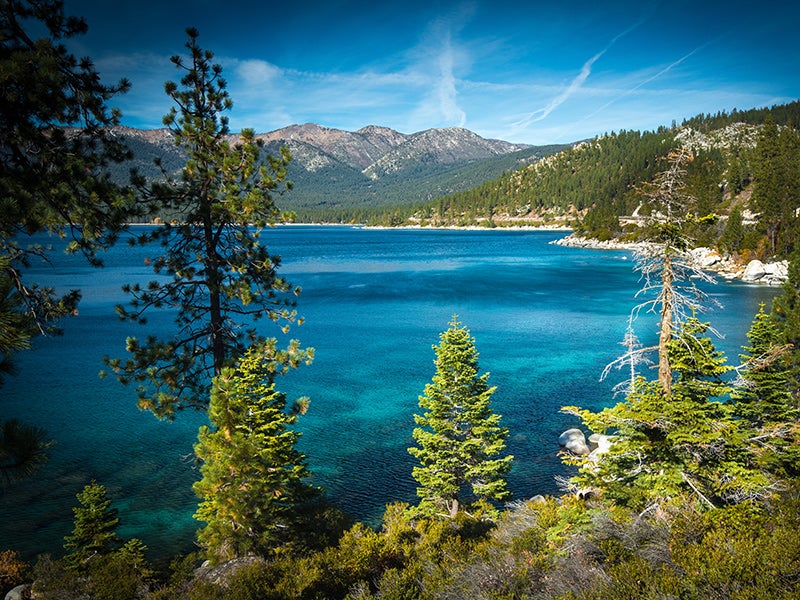
Case Overview
Straddling the border of California and Nevada, Lake Tahoe is the largest alpine lake in North America and is one of two EPA-designated “Outstanding National Resources Waters” in California. Due to increasing human activities and development, the lake’s famed water clarity, which once measured 100 feet deep, has declined 30% since 1968; summer clarity continues to decline at the rate of about one foot per year. The decline in water quality is largely attributable to fine sediments in urban stormwater runoff and the addition of nutrients that promote algae growth.
Earthjustice has filed three lawsuits against the Tahoe Regional Planning Agency, (TRPA) which was created in 1969 by California, Nevada and Congress to protect Tahoe in response to the failure of local jurisdictions around the lake to regulate development and preserve water quality. After a decade of continued exploitation of lands surrounding the lake, Congress revised the TRPA in 1980 to enforce stricter regulation through a new set of standards. Despite the stricter revisions, six of seven of the region’s water quality standards have not been achieved.
In 2008, TRPA adopted “Shorezone Ordinance Amendments,” which would have allowed the significant development of the shoreline. The new plan would have also allowed the construction of 138 piers and the placement of several thousand buoys along the lake’s shorezone that would cause increased degradation to the fragile environment. The structures would have impeded the public’s recreational access to the shorezone and degraded the lake’s natural scenic beauty. The plan would have also resulted in significantly higher levels of air and water pollution levels as the proposed infrastructure development would result in 62,000 additional motorized boat trips on the lake per year. Studies forecasted substantial impacts on water quality and fisheries resulting from major increase in fuel discharges, and combustion products such as nitrous oxides, particulate matter and hydrocarbons.
In November of 2008, Earthjustice challenged TRPA’s plan as violating the Clean Water Act and the agency’s own mandate to protect and restore Lake Tahoe’s natural beauty and health. Additionally, the agency’s environmental impact statement failed to address the project’s significant environmental impacts and failed to provide or define any realistic monitoring and mitigation measures. The lawsuit sought to stop additional shorezone development until the TRPA could show that the plan would achieve the region’s standards.
In September of 2009, a federal court judge issued a preliminary injunction halting the construction of new piers, boat ramps and other boat facilities as well as the placement of new buoys along lake’s shoreline until the case could be heard. In 2010, the judge overturned TRPA’s plan as it violated the Clean Water Act and the Tahoe Regional Planning Compact.
Unfortunately the victory was short-lived. In December of 2012, TRPA handed off basin-protection responsibilities to local governments by issuing a severely weakened regional plan. The new plan allows increased urbanization and several large recreation resorts around the lake that would further degrade the environment and obstruct views of the lake’s spectacular shoreline and waters. The new plan also weakens protection for the lake and surrounding land by permitting local counties and cities the authority to oversee development decisions. This delegation of critical environmental protections to local jurisdictions may result in less regulation, increased pavement and runoff, and murkier water.
In February of 2013, Earthjustice filed another lawsuit challenging these new regulatory changes as they erode the lake’s environmental protections by allowing local governments around the lake to adopt weakened pollution controls that don’t meet TRPA’s water quality standards. In March 2014, a federal court ruled in favor of TRPA, allowing new development to continue under the regional plan; an appeal is currently pending.

Case Updates
Case page created on December 19, 2008.
