Coal’s Toll on Colorado’s Forests
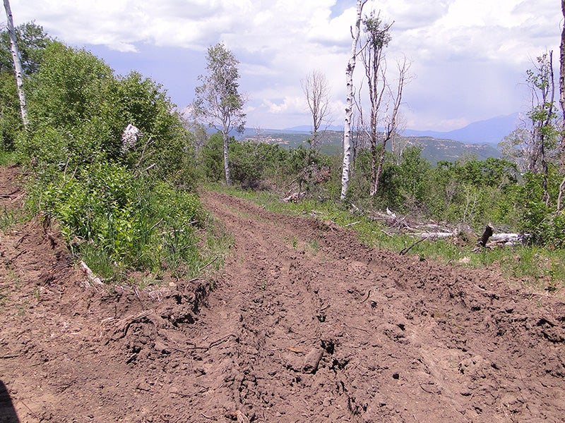
Photos by the Forest Service—obtained through a Freedom of Information Act request—give graphic evidence of underground coal mining's impacts on Colorado landscapes that provide a home for black bear and elk, beaver and the elusive lynx.

Recent photos by the U.S. Forest Service—obtained through a Freedom of Information Act request filed by Earthjustice on behalf of WildEarth Guardians—give graphic evidence of underground coal mining’s impacts on landscapes that provide a home for black bear and elk, beaver and the elusive lynx.
The coal may be underground, but a tight web of industrial facilities is built through our forests to vent methane gas—a potent climate pollutant—from the coal seams.
By proposing to reopen a loophole in Colorado’s Roadless Rule and attempting to reverse a ban on coal mine road construction won in court last year by Earthjustice and our allies (WildEarth Guardians, Sierra Club and High Country Conservation Advocates), the Forest Service has targeted Colorado’s Sunset Roadless Area for about 50 more drill pads and more than six miles of roads.
It’s a lose-lose-lose proposition: bad for wildlife, bad for those who enjoy national forests, and bad for our climate.
These photos show what the Forest Service has in store for pristine public lands—places that belong to you and me, and that should be protected for and enjoyed by future generations:
1 The process starts with the scraping of roadways through the forest, flattening terrain and denuding a swath of land of habitat value.
2 Then, up to an acre of forest is leveled to clear a place to drill a hole from which methane can be vented.
3 A drill rig is erected and operated. Bulldozers, backhoes, and a small cement mixer to provide casing for the drill hole crowd the pad.
4 A mud pit is dug to store water to aid drilling. (The water is sucked from nearby creeks.)
This entire process requires dozens of truck trips, with diesel engines spewing pollution and making a racket that carries for miles—all in an area that previously heard only the lively quiet of songbird calls and wind-rustled aspens.
The road and pad remain for years.
Only after the methane—a greenhouse gas more than 80 times more damaging than CO2 in the short-term—is released, will the mine “reclaim” the area.
5 “Reclamation” involves recontouring the land, and throwing some seeds on the ground. A bare-dirt scar on the landscape is initially what remains. Invasive weeds can out-compete native vegetation, with toxic herbicides brought in to reduce infestations. It will be decades—if ever—before habitat similar to that that the Forest Service allowed to be cut down is restored.
THE PHOTOS ABOVE show what has already happened to parts of our national forests. They act as a prologue and a warning to what could also happen to the Sunset Roadless Area and nearby Flatiron and Pilot Knob Roadless Areas—19,000+ acres—if the Forest Service has its way.