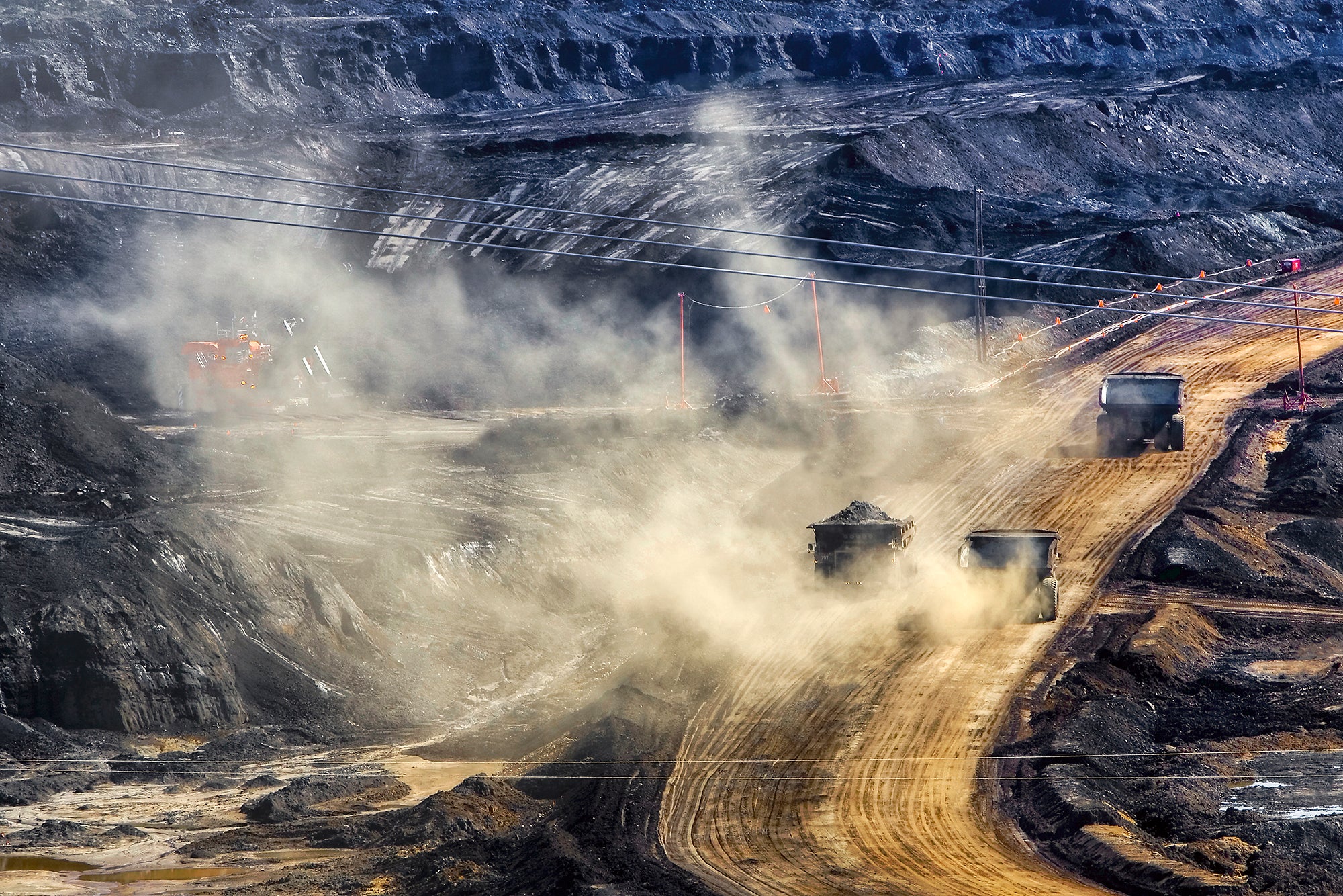

A Warrior’s Path and the Pipeline That Could Cut It
Earthjustice will stand with our partners to challenge Keystone 2.0 in court if the government agencies charged with avoiding such devastation fail to follow the law.
Among the Northern Plains Tribal cultures, there is a custom that forbids the cutting of a connection that exists between abstract or physical objects, peoples, and places. For example, during an honoring ceremony, a family may request that the person’s path not be crossed while they are being honored. To do so would cut the honoree from their path to future success. This custom can also dictate that a path between a person and a sacred object, like a ceremonial pipe or a sweat lodge, is not crossed because the spiritual connection can be severed.
On a larger scale, the cutting or severing of a person’s connection to their land is equivalent to severing their connection to their family and culture. Historically, conflicts arose when the U.S. government approved and constructed roads and railroads that cut through Tribal territories. Most notable was the construction of the Bozeman Trail, which cut through treaty-protected lands. The cut spurred Red Cloud’s War and resulted in the 1868 Fort Laramie Treaty, which explicitly required consent before any crossing of Tribal lands.
Today, Tribal peoples still adhere to old customs prohibiting cutting, which are evoked when oil pipelines are positioned to cut through culturally significant lands. Recently, President Trump issued a permit allowing for the construction of a massive tar sands oil pipeline across the Canadian border. The proposed pipeline would originate in Alberta, Canada (the so-called Prairie Connector segment); traverse through eastern Montana and Wyoming (the Bridger Expansion segment); and eventually end up at refineries in Cushing, Oklahoma.
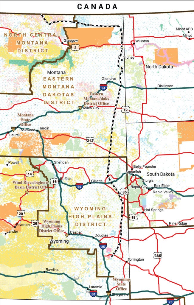
The proposed Bridger Pipeline, the black-and-white striped line in the map above, could have the capacity to carry up to 1.13 million barrels of tar sands crude oil per day. See larger map and map legend. (BLM)
The project, proposed by U.S.-based Bridger Pipeline and Canada’s South Bow (spun off in 2024 from former Keystone XL-proponent TC Energy), could have the capacity to carry up to 1.13 million barrels of tar sands crude oil per day. Tar sand produces a particularly pernicious type of crude due to its extraordinarily high life-cycle climate pollution and difficulty to clean up if it spills into the environment. Some have referred to this project as Keystone 2.0, and it would come with a host of potential significant impacts on the surrounding region and peoples, just as its predecessor did.
The proposed pipeline threatens the economies and health of local communities and would cross major rivers, tributaries, and recreational and agricultural lands. For the Bridger Expansion segment alone, it would cut through lands significant to Tribal Nations and Montanans, including unceded Indian territory defined by the 1868 Fort Laramie Treaty. The pipeline risks significant environmental, cultural, historical, and economic impacts, and contributes to increasing distrust of government agencies. For Tribal Nations and tribal members like me, this pipeline represents the reopening of old wounds and a revival of the history of the government’s failure to keep its promises.
The Bridger Segment Would Cut Through Treaty-Protected Lands of Cultural Significance
The proposed Bridger segment, much like the Bozeman Trail, would cut through treaty-protected lands identified as unceded Indian territory — lands shared for Tribal hunting and continued use. The Tribal Nations who shared this territory were the several bands of Lakota, Northern Cheyenne, Arapaho, Gros Ventre, Assiniboine, Mandan, and Arikara. Today, the unceded Indian territory is comprised of Tribal, private, and public lands, of which Tribal peoples continue to maintain cultural and spiritual connections.
For the Lakota, Northern Cheyenne, and Arapaho, the eastern part of Montana and Wyoming are of great cultural and spiritual significance because of the location of numerous sacred sites. My family and others of the Northern Cheyenne Tribe continue to make annual pilgrimages to conduct ceremonies at places like the Black Hills National Forest, Bear Butte State Park, and Devil’s Tower National Monument. For as long as I can remember, the journey is as important as the destination, and it was common practice for family members to tell stories along the way.
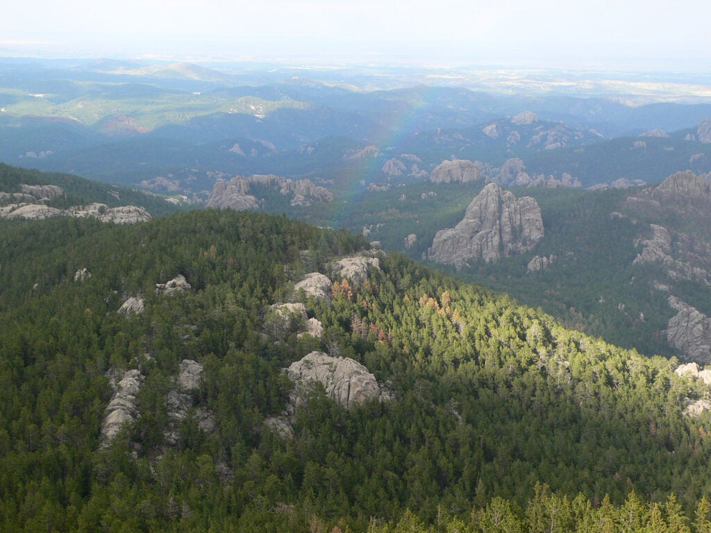
Areas including the Black Hills National Forest are of great cultural and spiritual significance for the Lakota, Northern Cheyenne, and Arapaho. (Vocaro / CC BY-SA 2.0)
When I became a parent and continued to make these family excursions, I followed the same tradition, relying on the landscape to remind myself of our peoples’ previous lifestyles, journeys, and experiences. I was also burdened with the responsibility of telling stories of ancient hunting practices, which can evoke memories of the Cheyenne peoples’ past wealth and prosperity. Our stories are preserved in the hills and rock formations and sites like the Vore Buffalo Jump in Sundance, Wyoming. Southeastern Montana has a unique beauty and is also known to have numerous hidden man-made stone and earth structures that were used to trap pronghorn antelope and deer. I have personally heard elders talk about these pits or drives which are smaller than buffalo jumps, but similar in utility, and the Cheyennes remember these hunts as pre-reservation ceremonies. If a pipeline is constructed through this area, it could potentially disrupt or destroy these structures. It would most certainly cut the cultural blueprint that Cheyenne families continue to value as part of their collective cultural memory.
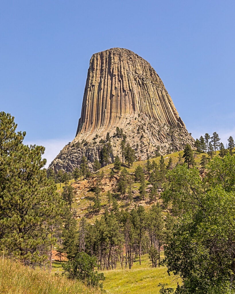
Members of the Northern Cheyenne Tribe continue to make annual pilgrimages to conduct ceremonies at places like Devil’s Tower National Monument. (Tim Lumley / CC BY-NC-ND 2.0)
The Bridger Segment Would Cut Through Shared U.S. History and Montana Culture
In 2007, the Montana State Legislature formally designated the Warrior Trail Highway in honor of the path that both the U.S. Army and the Lakota, Cheyenne, and Arapaho Tribal Nations trekked during the Great Sioux War of 1876. The Warrior Trail runs along Highway 212 and stretches between the Little Bighorn National Monument and the Wyoming border. The trail promotes tourism, honors the region’s history, and highlights numerous national landmarks and places, attracting out-of-state and international tourists to this region. Yet, the proposed Bridger path would cut through it, literally and figuratively.
It just so happens that the pipeline was proposed amidst the 150th Anniversary of the Great Sioux War, which Montanans and Tribal nations celebrated at commemorative events for the Reynold’s Battle in Broadus, the Rosebud Battle at Rosebud State Park, and the Little Bighorn Battle at the National Monument near Crow Agency. Every year Tribal groups ride horses on the Warrior Trail visiting sites. I grew up in Busby, also on the Trail, and would be disappointed if any of these events were impacted by pipeline construction.
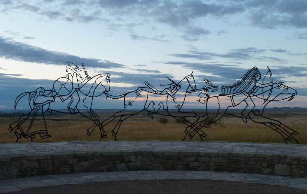
The Indian Memorial at Little Bighorn Battlefield National Monument commemorates sacrifices made during the battle. The Warrior Trail runs along Highway 212 and stretches between the national monument and the Wyoming border. (Jeff Myers / CC BY-NC 2.0)
We cannot ignore the cultural and historical significance of the Great Sioux War of 1876 because it shaped the country, local communities, and Tribal relations. Despite the violent and painful history of the conflict, Montanans today — both Indian and non-Indian — honor and learn from this shared history and respect the lands and places where this history has occurred. This year’s commemorative events brought people and communities together. The Little Bighorn Battle signified the last major resistance of free Tribal Nations against U.S. invasion. The events leading up to the battle tell a story of centuries of the U.S. government’s failure to establish and maintain peaceful relationships with Tribes, broken treaty promises, unchecked extraction of gold, and an imposition of a reservation system. Nonetheless, Montanans and Tribal peoples appreciate this shared history with a desire to learn from it. The Warrior Trail promotes the appreciation of the shared history.
The Pipeline Would Cut Through the Public’s Trust
The U.S. Bureau of Land Management and the Montana Department of Environmental Quality are facing criticism from a coalition of Indigenous, conservation, and community groups for failing to commit to adequate public comment opportunity on the pipeline. In the Federal Register notice for the pipeline’s Bridger segment, the U.S. Bureau of Land Management states that it “may provide additional opportunities for public participation,” including a 30-day comment period. And yet, project documents indicate that Bridger is still gathering information about critical aspects of the project.
The Montana Department of Environmental Quality also appears to be putting its finger on the scales in favor of industry by granting an undisclosed waiver to allow Bridger to omit required information from its project application. Such a waiver cannot be granted without public notice or public hearing. These actions are telling of the government’s failure to make transparent decisions, failure to acquire free prior and informed consent, and its ability to break promises and extract resources that will only benefit a select few.
Earthjustice formally submitted public comments opposing the proposed Bridger segment, representing a broad coalition of 15 organizations, arguing that the 647-mile, 36-inch diameter pipeline threatens clean water, ecosystems, wildlife, and lands of ecological and cultural significance in the Northern Rockies. We will be closely examining the impacts of the recently-announced segment from Wyoming to Cushing, Oklahoma to ensure potential impacts are properly assessed there as well.
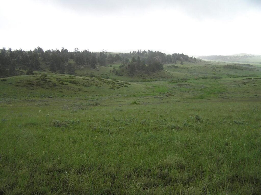
Rosebud Battlefield State Park commemorates the Battle of the Rosebud of 1876. We cannot ignore the cultural and historical significance of the Great Sioux War of 1876 because it shaped the country, local communities, and Tribal relations. (NPS)
The proposed construction of an oil pipeline without proper consultation and comment would be irresponsible and another betrayal of the government’s trust responsibility to Tribal nations and to the public. The pipeline’s story has already followed a trend of government unilateralism and procedural failure. Without robust public scrutiny, it threatens environmental and cultural devastation. That is why Earthjustice will stand with our partners to challenge this pipeline in court if the government agencies charged with avoiding such devastation fail to follow the law.
It is time for tar sands pipelines like Keystone 2.0 to recede into history, so they can be remembered as reminiscences of an obsolete technology from a failed era of extreme extractivism.
Leo K. Killsback is a citizen of the Northern Cheyenne Tribe of Montana and works in Earthjustice’s Northern Rockies Office. The views expressed in this blog are personal and are not made on behalf of the Northern Cheyenne Tribe.
Established in 1993, Earthjustice's Northern Rockies Office, located in Bozeman, Mont., protects the region's irreplaceable natural resources by safeguarding sensitive wildlife species and their habitats and challenging harmful coal and industrial gas developments.
Perry Wheeler
Public Affairs and Communications Strategist, Earthjustice
pwheeler@earthjustice.org