Where are organophosphate pesticides used?
The following maps document the widespread extent of agricultural pesticide usage for 14 of the most harmful organophosphate pesticides. How these maps were made.
 5.03
5.03Pounds per square mile of harvested cropland (log)
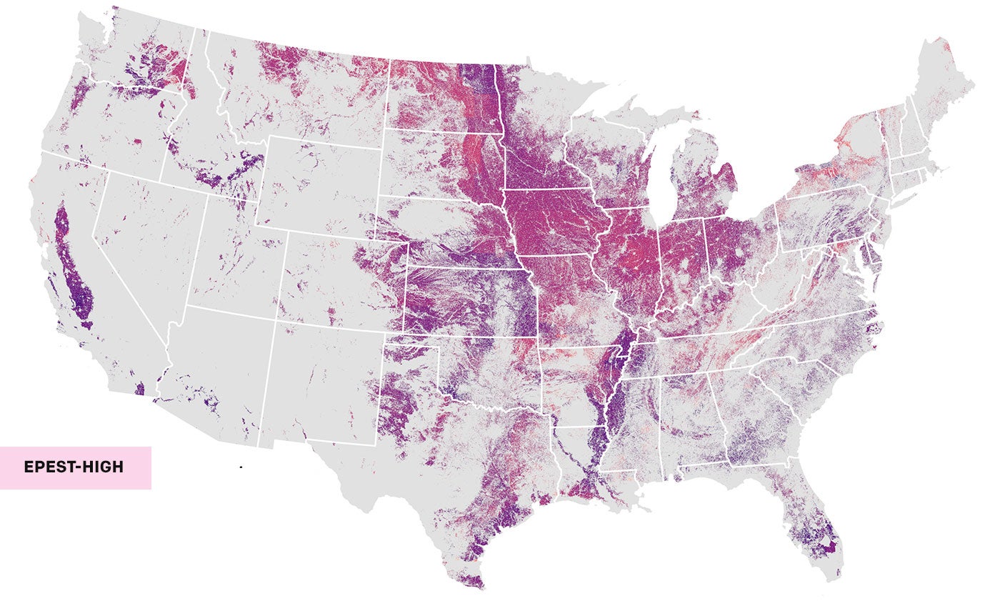
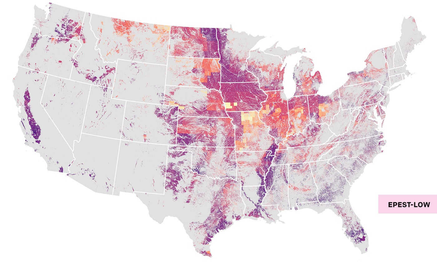
The overlayed maps above compare concentration of pesticide use for the most recent year of reported data for 14 of the most dangerous, commonly used organophosphate pesticides, allocated across all harvested cropland. (See map notes and health impacts of organophosphate pesticides.)
The overlayed map on the left displays U.S. Geological Survey's EPest-high estimates, which relies on pesticide use data from crops in neighboring or regional “crop reporting district” to estimate unreported crop-specific pesticide use data. Thus, EPest-high is more likely to reflect restricted pesticide uses.
Data from the same year, using USGS's EPest-low estimates, is on the overlayed map on the right. EPest-low relies on models that assume zero use for any crop where pesticide use data was not reported within a “crop reporting district,” and thus more accurately reflect state-based pesticide use restrictions.
The following maps provide comparisons between EPest-low and EPest-high estimates over the same time period. Download the data.
Volume of Estimated Organophosphate Pesticide Use: By State and County
In the most recent reporting year available, 16 million pounds of the 14 organophosphate pesticides mapped were used in the 48 contiguous states, by EPest-low estimate. By EPest-high estimate, more than 28 million pounds were applied. There are dozens of organophosphate pesticides that still remain in use in the United States. Learn about the crops usage and health impacts organophosphate pesticides in these maps.


Concentration of Estimated Organophosphate Pesticide Use: By State and County
Concentrations indicated in the maps reflect the USGS estimates allocated to total harvested acreage for all crops reported in the county and total harvested acreage for all crops reported in the state, which includes harvested acreage for crops that did not have organophosphate pesticides applied to them.
For this reason, unless all harvested crops reported in the county or state were applied with organophosphate pesticides, the concentrations found on the maps are dilute in comparison to the true concentration. (More details.)


